Wednesday, December 26, 2007

Looking Back at 2007 (Trail Running Blog Tag)

Just when I wasn't looking over my shoulder, Scott Dunlap tagged me to continue the fun blog-tagging game that Paul Charteris started. Here are my answers to the six questions:

1. the most memorable moment on the trails was…
Meeting my friends Grant, Marie, and their dog Artie at Mile 74 of the TRT100. I had walked by myself since mile 53 and it was cold and dark, so I was really looking forward to meet Grant and Marie at their campsite alongside the trail. However, I was not sure if they would still be up, because I had fallen behind on my projected schedule.


With Marie, Grant, and dog Artie (Photo by Alan Geraldi)


When I met Scott Dunlap on his way back from the turnaround point, I got a real boost when he told me that I had "a fan club" waiting for me about a mile ahead. When I finally arrived at the 74-mile point, seeing my friends and having a chair and hot coffee waiting was something I'll never forget. Ultrarunning is like that; it can strip you down to your core, leaving you with a renewed sense of gratefulness for the most basic and simple things.

Just when I thought about laying down for a bit, I was fortunate enough that Alan came by. We decided to walk the rest of the race together and the rest is history. Unfortunately, this would be one of the last times I would see Artie. Rest in peace, good dog -- you will always be in our hearts.

A close second (I know, that's cheating ;)) was running under the shooting stars at the 12 Hrs at Cool race. I had not fully recovered from TRT100 and started the race with a lot of Jet Lag. After a great first lap, I reached an incredible low and was reduced to simply walking, wondering if I would be able to run again that night. After a quick break, however, an unbelievable runner's high kicked in that just kept going and going. Combine that with tons of shooting stars, some good tunes, a great crew (Thanks Chris!), and an awesome RD (Nancy) and race volunteers it made for one of my most memorable runs ever (and yes, the stack of pancakes at the end also helped!).

2. The best new trail I discovered in 2007 was…
Tahoe Rim Trail Section 8 between Ward Creek and the intersection of the TRT and PCT at Twin Peaks. I hiked this section for the first time with Sean in November. The views in the area around Twin Peaks are simply unbelievable. We just could not get enough of the beautiful views that stretched out in all directions.

3. My best performance of the year was…
Although I had a great, first overall 10K victory at the Daffodil Run 10K and I ran my best 50K ever at Sunsweet Wildflowers 50K in April (2nd overall in 4:06), I would say that my best performance of 2007 was the combination of the Sierra Nevada 53-mile Endurance Run (1st overall) followed by the Draft Horse Classic 5K (3rd AG), and the Tahoe Super Triple (1st overall), all in a single week.
That string of races actually sums up my 2007 race year. The two series I was running in, as well as my favourite race, the Tahoe Super Triple, happened to have five events planned in one seven-day period: On the first day, a double marathon, on the second day, a 5K, on the 5th and 6th day, two marathons, and on the 7th day a 72-mile race. (Wait! This is starting to sound like a familiar Christmas song!).

Leading up to this, I had to think long and hard about what to do. Unlike runners like Chihping, running a 53-mile race five days before the Super Triple was not something I would have planned. In the end, I prioritized the races and I was going to throw everything I had into the Sierra Nevada double marathon in an effort to score top points in the ultrarunner.net series. I accepted that this would most likely cost me first overall in the Gold Country Grand Prix Series and perhaps the overall win at the Super Triple as well.

I tapered for a few weeks before the 53-mile run, ate extremely healthy, and watched my race weight very carefully. More importantly, I focused on visualizing that running and winning this series of events was possible, without going into unrealistic imagination. In the end it all worked out much better than I could have dreamed off, but I could not have pulled it off without the help of my family, my Tahoe/Indy 500 pit crew, and the support and positive energy from all my running friends!
4. I do not know how I previously survived without...
Bottle Lights, of course! If you have not tried these super handy lights on your water bottles (The Black Diamond Ions weigh less than one ounce), you don't know what you're missing in the early hours of the race. Actually, you will know what you're missing when you trip over a root or when you miss the course markings!

5. The person I would most like to meet on a trail in 2008...
My dad. He recently had a health-related setback, but fortunately he is on the road to full recovery again. The way he dealt with it has been very inspirational and I would love to see him back out on the trail during the August 2008 TRT Thru-Run.

6. The race I am most excited about for 2008...
That's the easiest question to answer: My TRT Speed Record Attempt, scheduled for 16 August 2008. I have wanted to run the entire TRT (165 Miles) in one go for a while now and I am going to focus my training exclusively on this event. Apart from trying to break Tim Twietmeyer's record, this event is just as much about testing my own endurance and having fun with friends and enjoying the trail.

I am super-excited that several fellow runners have already offered to run sections of the trail with me; that should help out tremendously! I'll be posting more about the TRT Thru-Run and next year's schedule in upcoming posts.
Now Tagging:

Monday, December 24, 2007

Take the Quad Challenge!

I recently read The Ultimate Hiking Skills Manual. This little book is well-written and filled with good tips about hiking in the mountains. The first chapter starts with a fun quadriceps strength test to assess your mountain running and hiking readiness. As you all know, your quads supply the strength needed to power uphill and bomb downhill.
So, similar to the Rogue Valley Runner's Park Street Challenge, here's a challenge that you can do from [the comfort of] your home or office -- just post a comment with your results.
Instructions:
1. Stand with your back against a wall. Shuffle your feet away from the wall and lower your body until your knee joints are at a 90-degree angle. Keep your feet facing forward, directly underneath the knees. Keep your head against the wall and let your hands hang to your sides (don't cheat by putting your hands on your legs). See Sean and Rocky's demonstration above and below.
2. Once you are in position, start your stopwatch. Stay in this position for as long as you can. When you can't handle the quad burn anymore and you fall down on the floor with your legs still shaking wildly from the pain, stop your stopwatch and see how well you did. Note: It's amazing to see what happens to your quads over the course of a few minutes.
3. See how well you did and post a comment below with your time and other comments. Repeat this as many times as you want.
  • Less than 15 seconds: Shocking, don't plan on any speedy ascents unless they are on a train.
  • 45 Seconds: Could do better, some more hill work needed.
  • 1 Minute and 15 Seconds: Okay, do three sets of 20 squats a day to build up your quads.
  • 1 Minute and 45 Seconds: Good, ready for some of the classic routes.
  • 2 Minutes and 15 Seconds: Impressive, you sailed through the pain barrier with flying colors.
  • 2 Minutes and 45 Seconds: Top notch, your quads testify that you're used to pushing yourself through the limits.

The Results (so far...):
  • Vicky: 1:15
  • Rocky: 2:21
  • Sean: 4:00
  • Peter: 5:45
  • You: ? -- Leave a comment below with your time!

Warning: Don't do this if you have knee problems.

Tip: Playing some music (or doing this during a conference call, provided you are on mute so others don't hear you collapse at the end) can help and won't be considered cheating.

Have fun!

Saturday, December 8, 2007

An Interview With Tahoe Rim Trail Speed Record Holder Tim Twietmeyer

When I was getting some alternate directions to a closed trailhead the other day at Tahoe Dave’s in Tahoe City, I explained to the friendly folks there that I wanted to run the entire trail in one go next summer. The girl behind the counter replied that her boyfriend had gone out and hiked the entire trail in eleven days straight and that was considered super fast! Well, you should have seen the stunned look on her face when I told her that Tim Twietmeyer had run the entire trail non-stop in just under 46 hours (45:58)!

To ultrarunners, you don’t need to explain who Tim Twietmeyer is. Tim is an endurance legend; he has completed the Western States 100 mile race an unprecedented 25 times (all sub-24; first place five times; current master’s course record holder). Tim is also the first runner to complete the Tahoe Rim Trail in less than two days. All this fame has not gone to his head though, Tim, who is a development manager at Hewlett Packard, is also a great guy and he is always happy to share tons of useful information about his running adventures.

I first met Tim at a trail and ultrarunning presentation that he hosted at Fleet Feet in Sacramento this spring. I asked him a few questions about his TRT thru-run. Personally, I had thought about running the entire TRT in one go for years and of course it would be great to try to set a speed record in the process. That record had been around 55 hours for several years, which seemed fairly soft. However, Tim had come in and methodically knocked about seven hours of the overall time. After the presentation I drove home both inspired and impressed.

Always interested in how people plan and accomplish a thru-run of the TRT, I contacted Tim to ask him if he would want to takes some time out of his busy schedule to answer some interview questions on my Run Lake Tahoe blog. He graciously accepted -- yet another confirmation of how great and supportive the ultrarunning community really is; legendary professionals taking the time to talk to the amateurs. You don’t find that in many other sports! The following is my recent interview with Tim about his record-breaking TRT thru-run in 2005.

About the TRT Speed Record

PL: When did you thru-run the entire TRT in one go?
TT: August 27-29, 2005

PL: What was your exact time?
TT: 45:58; I started on Saturday at 5am and finished at 2:58 on Monday morning.

About the Run

PL: Where did you start?
TT: I started at the bridge over the Truckee River in Tahoe City (in the 64-acres parking lot).
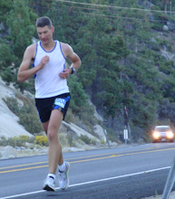
Tim at the Start in Tahoe City

PL: In which direction did you run?
TT: I ran clockwise

PL: Why did you pick that course (start and direction)?
TT: No particular reason other that it was the easiest access from where I was coming from (Auburn). It’s also the lowest point on the trail. One reason that I went this way was to get through the driest part of the course (east side of the lake) when I was fresh(er). There’s about a 20-mile stretch of the trail without any close natural water, so I figured it would be better to do that on the first day than on the second. Also, it looked like getting over Dick’s Pass on day two would be better than trying to get over Radio (Relay) Peak (10,338'). After doing it, it would be interesting to pick an easier stretch to run at night. The south shore was very difficult in the dark.
PL: Why did you pick August to run it (sounds pretty hot)?
TT: I was hoping to do it earlier in the year so that I’d have more light to run with, but it didn’t work out with WS100 and some other events I was involved with. It was also the best weekend for my crew.

PL: Which sections were the easiest?
TT: Two sections:
First was Brockway to Tahoe Meadows, most because that section is absolutely gorgeous and I ran into some Reno runners along that stretch.
The other was From Echo Lakes to Dick’s Pass. The terrain wasn’t particularly easy, but I got two milk shakes at Echo Lake and then got a chance to meet a lot of hikers that were headed out of the wilderness as they headed back to their trailhead on Sunday afternoon.
Tim Enjoys a Milkshake at Echo Lake

PL: Which sections were the toughest?
TT: There were two very difficult sections:
The first was from Kingsbury South to Big Meadow. That was all run in the dark, it has some of the highest altitude on the lake, and it was when I started to feel the mileage. It’s at about 75-100. It’s also when I started getting an extremely dry throat from the dry air and I was having trouble eating solid food.
The second tough section was from the Velma Lakes to Barker Pass. Much of that is in forest and it meanders in several different directions. It’s very difficult to get a bearing of where you are and it just seemed to take longer than I expected. If any part of the trail is longer than advertised, that was it. It was also getting late in the second day and there’s very little consistency to that part of the trail, just a lot of random up and down through what is mostly low lying or forested areas. It was at this part of the trail where my pacer (Mark Falcone) started getting tired of my crankiness.
About Crewing and Pacing

PL: Some sections are hard to get to and trailheads can be many miles apart. What was the biggest single stretch you had to cover?
TT: There were two difficult stretches for crewing:
The first was Tahoe Meadows to Spooner as there is no natural water in that section, so I had to pack it with me (full 100-ounce pack with two hand bottles). My crew hiked up the trail a bit to meet me. It’s about a 4.5-hour stretch and you have to carry all your own stuff. Not only that, it was during the hottest part of the first day (1:30 to 6).
The other difficult section was from Echo Lake to Barker Pass. It’s over 32 miles. Although it has water that we could pump for drinking, we had to carry all our food and being through the middle of the second day, it took us a long time to get through there (9.5 hours).
At the Finish with Pacer Mark

PL: How many pacers did you run with?
TT: I started by myself and ran the first 40 miles to Tahoe Meadows (Mount Rose) by myself. It was nice to run that early morning stuff by myself, as it was extremely peaceful. At Tahoe Meadows, I picked up my first pacer, who ran to Kingsbury south. My second pacer picked me up at Kingsbury south and ran with me to Echo Lakes. My third pacer went from Echo Lake back to Tahoe City.

PL: Did you use spots other than the regular trailheads to resupply? (That is, are there any places where a crew could get pretty close to meet you in the middle of a long section)?
TT: Yes, my crew met my on Martis Peak Road. It’s not a trailhead, but it is vehicle accessible. That was it for help between the roads other than my crew hiking up a bit from Spooner Lake.
Tim and Mark Leaving Echo Lake

PL: I noticed there is no cell phone coverage everywhere. How did you stay in contact with your crew/pacers?
TT: We didn’t. They just waited. We made a cell phone call from up on Dick’s Peak, but that was it. Cell phones could come in handy, but we had everything we needed in the crew car, and we weren’t in any big hurry, so we had time to stop, eat, and then continue.

About Night Running

PL: I guess you ran straight through for two nights. Did you sleep at all?
TT: Nope, no sleep at all. It would have been tough to stop, sleep, and then get going again. The best time to sleep would be during the day, as it’s warmer and you wouldn’t need to bring a sleeping bag. That’s also the best time to run, so we just kept pushing to finish without a prolonged rest.

Tim Leaving Tramway (Kingsbury South)

PL: Did you try to time it to be at specific sections for the night runs?
TT: Nope, the night running, particularly on the south shore was a lot slower than expected. That’s where I lost a lot of time. It took me 7 hours to run 23 miles. There’s a lot of uphill in that area, quite a bit of it is above 9000 feet, and it was some tough running in the dark

PL: What time did you start and end?
TT: What sort of nightlight/headlamp(s) did you use? I was using headlamps and a hand light. I had a Petzl Myo and an LED hand light. My pacers had the same lights.

About Trail Marking

PL: How well is the trail marked?
TT: I thought the trail was extremely well-marked. The only time I got confused was in the ski resort at Heavenly. It was dark and the single-track came off a road, but it was difficult to find the junction. It was nice we had a GPS with us to find that location. Other than that, we didn’t need the GPS. We didn’t take it with us from Echo Lakes, which was probably a mistake as there was a couple of times when we questioned where we were going, but it was more out of my dopiness from being up for 40 hours than it was that the trail wasn’t marked.


PL: Was it hard to find the trail in the dark?
TT: Mostly not. On the south shore we had no problem once out of the ski resort. On the approach to Tahoe City, there was one intersection that had us a bit confused, but we figured it out pretty quickly.

PL: Did you use a GPS system (if so, what kind?) during certain sections?
TT: I had a Garmin Legend with me during the first night, but didn’t use it other than to get out of Heavenly.

PL: I have been recording different sections of the TRT on my Garmin Forerunner and have glued some tracks together. Is there an official TRT GPS track that you can buy/download anywhere?
TT: There’s a downloadable route on the National Geographic TOPO sharing site. I picked up my route and some printed maps from TOPO, and then downloaded the routes to my Garmin.

About Trail Gear

PL: What type of hydration pack or other water supply did you use?
TT: I used a 100-ounce The North Face hydration pack on the longer, drier stretches and hand-bottles on the shorter stretches. In the Desolation Wilderness, we pumped water at Fontanellis Lake. That was the only time we used naturally available water. The rest was carried from trailhead to trailhead.

PL: What type of nightlights did you use?
TT: Petzl Myo 5 headlamp and Streamlight LED hand lights.

Tim Climbing the Trail At Brockway Summit
PL: What kind of clothes did you wear (Running clothes, extra layers, etc.)?
TT: I had some custom sleeveless shirts made for my crew and me by Fleet Feet. It was standard tech-fabric stuff. At night I had a long-sleeve and took arm warmers and tights. It was very cold the first night and into the morning.
PL: What kind of shoes did you wear?
TT: The North Face Ultra 103’s and Nike.
Did you use trekking poles?
TT: Yes, during the night on the south side of the lake I used trekking poles, but ditched them once it got light again.

PL: Was there anything else that you really needed?
TT: Not really. I had a good set of maps that I was using, including the TRT map available from Take it Outdoors.

PL: Did you bring music?
TT: Of course, I was running along for the first 40 miles, so I listened to music during that stretch.

About Nutrition

PL: I can’t imagine eating power gel for that long. What did you eat?
TT: Early on, I was eating real food like Clif Bars, PB&J sandwiches, and also liquid nutrition (Boost). Later I went to broth and Starbucks Mocha drinks in the bottle. Any chance I got, I had ice creams or a milk shake (Kingsbury, Echo Lake). That was the best energy.

Taking some S! Caps at Spooner Summit

PL: What did you drink?
TT: Water, Cytomax, Boost, chicken broth, and bottles of Starbucks Mocha. Most of my calories were from Boost as I had a hard time swallowing non-liquids after Kinsgsbury due to a very dry throat from the altitude and dry air.

About the Experience

PL: What was the most memorable moment of your race?
TT: The most scenic was the north shore from Brockway to Relay Peak. The most memorable part was running with my friends through the night and the next day and sharing the trail with them. We had some really good laughs out there, particularly when I kept falling down after about 150 miles. When you’ve been up for over 40 hours straight, you go from being ornery and cranky to laughing about ever 15 seconds.
Tim Leaving Brockway Summit

PL: Was there anything you would have done differently?
TT: I would’ve continued to suck on hard candy early in the loop as my throat got so dry it was difficult to eat solid food without gagging.

About Training

PL: How did you train for this event?
TT: I just used residuals from training for WS and two 100-mile bike rides I did with my local cycling friends. I also trained near my house on some steep uphills, practiced with my trekking poles and carrying a heaver pack.

PL: Was this the longest you had ever run before this run?
TT: 128 miles on the track in 1986

PL: Did you do anything different in training from let’s say training for a 100 miler?
TT: I trained with a hydration pack all the time and did a couple of trips to the trail to familiarize myself with the trailhead locations, particularly the start/finish and those that were easily accessible by car.
Icecream at Kingsbury!

PL: Can you give me any training suggestions?
TT: If I were to do it again, I’d go on one of my long weekend fastpacking trips in the Sierras, just to do some really long days of hiking and to get familiar with carrying a pack. If you plan to use trekking poles, practice, build up your arms and learn how to use them more efficiently.

PL: Apart from the physical training, were there other preparations you made (maps, reading, recon of the trail, mental preparation)?
TT: Yep, I scoured the tahoerimtrail.org site for information. I bought the maps, and read some of the TRT book, mostly for descriptions of difficulty and locations of trailhead locations and possible crew access other than at the road crossings. I also downloaded the trail from the National Geographic site to my Garmin Legend. I went on one trail recon trip to see how good the markings were. That wasn’t a problem; the trail was extremely well marked. The best resource is the Take it Outdoors map of the TRT. From that, you can easily assess strategy, crew access, and where it would be best to start and end.

About the TRT

PL: I recently read an article in a Tahoe Forest Conservation magazine about your involvement in sustaining the trails around the lake. Can you tell me how you are involved in trail and forest conservation?
TT: Mostly through the Western States Endurance Run Foundation. We have a partner organization (the Forest Foundation) that works with us to repair trail, understand forest management, and to help reforest areas that have been damaged by fire.
Tim At Snow Valley Peak

PL: How long have you been a member of the TRT organization?
TT: Just since before my run. I’d never been too familiar with it all before then.

PL: How can we get involved in caring for the trails, specifically the TRT?
TT: Go to the TRT web site http://www.tahoerimtrail.org/ and volunteer or make a donation. With much of the trail in wilderness areas (Desolation Wilderness, Mount Rose), those trails cannot be maintained with powered equipment, so it requires all handwork, which is very labor intensive. Go contribute on a trail work day. If you’re interested in the Western States Trail, there are trail projects going on almost year round. Just go to the http://www.ws100.com/ web site and find the trail projects section. It’s a lot of fun. A half-day of work, then barbecue, and go home.

What’s Next?

PL: You seem to like these sorts of solo adventures. Do you have any other epic long runs planned for the future? What about Capitol to Capitol (C2C)?
TT: Yes, this summer. Carson City to Sacramento, probably over 4th of July.

PL: What about a PCT record attempt?
TT: Nope, takes too much time. Maybe in pieces when my kids get older.

PL: Are your boys planning to do anything like this with you?
TT: This year I’m sure they’ll be out there for C2C. I want to finish in Sacramento and have a cigar with Arnold.

PL: Final question: Is there anything else you would like to share about the TRT or about your TRT run?
TT: Go do it, even if you do it in sections or have to backpack the entire thing. Each section has its unique beauty. Even a night run/hike might be just the ticket to experience the grandeur of the lake and mountains. One suggestion would be to do Mount Rose to Brockway on a full moon. That would be spectacular.

At the Finish with Pacer Dave and Tim's Father

PL: Tim: Thank you so much for taking the time out of your busy schedule to share all this with us, Tim. You’re a true ambassador to the trails and ultrarunning! I wish you the best of luck with your future running adventures.

Saturday, December 1, 2007

Walking in a Winter Wonderland (on Section 7 of the Tahoe Rim Trail)

I got up really early this morning to take advantage of what could have been the last snow-free weekend this year. I wanted to hike section 7 of the Tahoe Rim Trail (TRT) from Echo Lake to Barker Pass in preparation for next year's thru-hike. This 32.5-mile section is the longest single stretch of the TRT (between the official trailheads) and travels for about twenty miles through Desolation Wilderness.

As I drove up to Echo Summit on Hwy 50 around 6:30 a.m. I could just see the faint outlines of the massive mountains and for a moment I felt like I was in a different country. I had packed a lot of clothes, because the weather forecast had predicted a cold and dry day. They were right about the cold; it was FREEZING! The dry weather, well, that's another story.

I found my way to the Echo Lake trailhead. There was only one other car, which looked abandoned. This in stark contrast to the last time we went her on Memorial Day; we could hardly find a spot to park that time. Today, however, the Chalet was closed for the season and the boat service that normally runs on the hour had also packed up for the year. Everything looked abandoned.

The first flocks of snow started to fall I was putting on my different layers. I had enough water, coffee, pb&js, pretzels, and other goodies to make the 32.5 mile hike, but the sky looked ominous. I took off right around 7 and made it to the start of Desolation Wilderness (after about three miles) in about 45 minutes. The snow was just starting to stick a little bit, but by mile five, I was already walking through about two inches of snow.


Upper and Lower Echo Lake (Photo from Memorial Day Hike, the camera was frozen)

For sure, I was not going to be able to hike the entire distance. I would need to get my truck off the mountain or face having to live in the public restrooms at the trailhead until May. I pushed on past Lake Aloha to Mosquito Pass and it started getting pretty slick on the rocky sections. The snow covered several icy rocks and I barely caught myself from wiping out completely a couple of times. This was not a good time to get hurt -- even with all the extra layers (two pairs of pants, two pairs of gloves, and five layers on top), it was still freezing cold (Even the water in my CamelBak froze!) and there was nobody on the trail.

I headed back after about 6.5 miles and took it slow on the way back. I had some coffee and a few sandwiches while taking cover from the snow behind one of the many weathered, old pine trees. Sitting there and taking in the winter landscape was truly spectacular.

I made it back to the truck and was able to get back to the highway without any issues, but I don't think I could have waited much longer. I'll just have to check out this section next summer. Before going home, I checked out a few of the other trailheads nearby and of course I could not pass up a scrumptious plate of nachos at Sprouts.

I also picked up a pair of new trekking poles on my way home and I am eager to try them out in some mountainous terrain (trying lots of new things these days). I am also thinking of picking up snowshoeing this winter (the poles will work for both snowshoeing as well as trail hiking), so I can do something other than sit around and drink coffee while the kids are out snowboarding. We usually go to Squaw Valley (kids 12 and under only pay $10), but I don't know if you can snowshoe there. Does anyone know?

Monday, November 26, 2007

Hiking to Twin Peaks on Section 8 of the Tahoe Rim Trail


On Sunday, Sean and I headed up to Tahoe City to hike section 8 of the Tahoe Rim Trail (TRT). We were going to hike from Barker Pass to Tahoe City (16.7 miles) or to a secondary trailhead on Ward Creek Blvd. about 5.1 miles before Tahoe City.


Twin Peaks, Our Destination, in the Background
We left fairly early and stopped to buy some delicious sandwiches and pastries for later at Tahoe House Bakery in Tahoe City. Since it would just be the two of us, I parked my mountain bike at the bakery, because I would zip back up to Barker Pass to pick up the truck after we were done hiking.
Tahoe House Bakery
Unfamiliar with this section, I had read the instructions on how to get there in Tim Hauserman's The Tahoe Rim Trail: A Complete Guide for Hikers, Mountain Bikers, and Equestrians (a fantastic reference guide). Well, the book did not say anything about Barker Pass Road being closed after November 1st, but that is probably because it is very rare not to have snow on the mountains yet at this time of the year, especially on this section of the TRT. A gate blocked us from driving up the road, but there was another road (Blackwood Canyon Snow Area), which I thought might be an alternate way up to the pass. Taking that road, however, required a permit, so we drove around trying to find one of the stores that sells these permits.

Barker Pass Road -- Access Denied!
The friendly folks at the outdoor sports store Alpenglow in Tahoe City told us that there was no alternate road up to Barker Pass (the permit was only good for the snow area at the bottom of Blackwood Canyon) and then they told us how to get to another trailhead on Ward Creek Boulevard and we decided to just go for an out and back hike starting at Ward Creek.
View From a Peak Just Below Twin Peaks
We found the Ward Creek Blvd. trailhead easily (Hwy 89 South from Tahoe City, right on Pineland Dr, left on Ward Valley, which becomes Ward Creek Blvd. The TRT kiosk is a few miles up the road on Ward Creek Blvd.)

Right on Pineland...
Left on Ward Valley and continue on Ward Creek Blvd.

The Ward Creek trailhead does not have any facilities, but it is definitely a nice, easy-access crew point for a thru hike, because you have to cross the road right there anyway (mental note for next summer). The TRT/PCT junction, located just past Twin Peaks, would be roughly a 6.5 mile hike from the Ward Creek trailhead, making it a perfect out-and-back hike for us, especially since the "out" section featured a 2000' climb (6556'-8516').

I was trying out some new Montrail Hardrock shoes that I had bought on sale at REI. Now that the racing season is over, I want to try a lot of new things. I think I still have to find the perfect TRT trail shoe. As for the Montrails, I have to say these shoes require a little bit of wearing in. I had to get used to the shoes' weight and stiffer soles compared to my road shoes, but at the end of the day my feet felt good and they are definitely a comfortable ride. I'll have to break them in a bit more, but so far so good. (And no, I am not trying to get any free stuff out of this blog post, especially now that Montrail has pretty much disbanded their running team).
Montrail Hardrock Feeling at Home
The first few miles run along Ward Creek and are pretty flat. Some signs warn people not to remove fallen trees from the creek as they provide a habitat for lots of fish varieties, such as the Tahoe Sucker (and you thought that Tahoe Suckers were those people who come up to the casinos to deposit their paychecks in the slot machines!).
Fish, like the Tahoe Sucker, Rely on Fallen Logs in the Creek
The TRT reference guide book described crossing the creek at an old washed out bridge, but thanks to the efforts of the TRT organization, we did not have to get wet; a beautiful new bridge was built across the creek just this year and it still looked very shiny.
The New Ward Creek Bridge
After crossing the creek, the trail started to climb. In the distance we could see Twin Peaks and the trail wound itself trough meadows and woods to get there. Some of the sections were very steep. After hiking for about two hours, we stopped for lunch. We had worked up quite an appetite and those sandwiches sure tasted great!
Onwards! We kept climbing until we hit a huge rock formation just below Twin Peaks. We sat there for a while enjoying the gorgeous view of Lake Tahoe and then we climbed to the top, on the backside of Twin Peaks. The views at the top are simply amazing. Almost every corner turned into a Vista Point, one more spectacular than the other.
A Pratially Frozen Waterfall on the Trail
We decided to push on towards the TRT/PCT (Pacific Crest Trail) junction, but were pleasantly surprised when we reached it almost as soon as we passed Twin Peaks. Sean took a right turn and ran on the PCT (towards Canada) for about 50 yards. One day, when Sean and Rocky are old enough, we plan to hike the entire PCT (Watch out David Horton!).
TRT/PCT Junction
One of the Most Spectacular Views on this Section of the Trail
Nuun in the Afternoon at the Top
We headed back and in no time, we had covered several miles. We continued our hike and stopped for a few quick breaks. It was very quiet on the trail. All in all we only saw about five mountain bikers and 4 hikers. We walked back to the truck, picked up the bike, and headed home (not without a stop at Village Pizzeria in Truckee first, of course).
Trail Cleanup -- Leave No Trace? How About, Leave No Socks!
It looks like the weather is going to change after next weekend, so maybe I can hike yet another section next weekend...

Elevation Profile of the Twin Peaks Ascent Hike

Gordy Ainsleigh's Cool Yule Jingle Jog

At the end of last week's Turkey Trot, legendary ultrarunner GordyAinsleigh was handing out flyers for his Christmas Day run in Meadow Vista. A lot of you have asked me to provide some more information about the run, so here it is:

With Gordy (left) and Sierra Trailrunner Catherine, at the Run Through the Colors (Photo Courtesy of Catherine)

Cool Yule Jingle Jog
Preparing Mind and Body for Christmas Dinner

What?
5K Walk/Run 10K Run
This Year Only – A benefit for Gordy’s Tooth Fairy Fund
(The race director needs a tooth implant.)

Where?
Meadow Vista Park, Meadow Vist, CA
To get there, take Hwy 80 to the Meadow Vista Exit and use this Google Map for specific directions:

View Larger Map

When?
Dec 25th -- Registration starts at 10 a.m.; race starts at 10:30 a.m.

Fee:
$25 (preregistered before 12/16) $30 thereafter. Make checks payable to Placer Trails Conservancy.

Rules:
Start on time or shortly thereafter, follow marked courses and wear bells (provided) on shoes. Only runners may take the 10K course. No dogs out of vehicles until all runners are gone. Dog start is 10 minutes later.

Awards:
  • Red or green long-sleeve shirts (featuring a print of two Canada geese in flight) to all runners.
  • Large living bouquets from Eisley Nursery in Auburn + certificate to the first man and woman in both races.
  • Certificates (suitable for framing, featuring geese in flight) to 1st, 2nd, and 3rd place in all [approx. ten-year age] divisions.

Race Applications:

You can get an application (including the typical waiver of liability) from Gordy by sending him mail (H. Gordon Ainsleigh DC, PO Box 1087, Meadow Vista, CA 95722) or calling (530) 8 7 8 - 1 9 0 1. (Sorry, I don't have an e-mail address).

- - - - -

Merry Christmas! This should be a lot of fun. However, I don't think I'll be able to make it myself, because this is Christmas Day after all!

Saturday, November 24, 2007

Running the Michael Bratton II Memorial Turkey Trot


With Larry Defeyter (left) and Steve Bond (right)

On Thursday (Thanksgiving Day), I joined over 1100 runners and walkers for the second annual Michael Bratton II Memorial Turkey Trot in Nevada City. This was my last race of the year and the final race in the Gold Country Grand Prix series. However, I had already sort of stopped training seriously since the Helen Klein 50 Miler and I had, instead, been focusing on assisting my kids with emptying out their enormous Halloween baskets.

I needed a third place in my age group here, and, as Steve Bond pointed out in his "Run for Your Life" Union newspaper column, all I had to do was stay on the course, and [an Age Group] first would be mine.


Runners warm up at the start

To make sure I would stay on the course (something I had a problem with last year at the Draft Horse Classic 10K, and consequently cost me a top three place in my grand prix age group), I ran the course once with Sid Heaton the week before the race (thanks Sid!). As it turned out though, the race was organized impeccably, and getting lost was not an issue. Volunteers lined the many intersections of the course and even the local police was out at some of the more dangerous intersections.

Sean was guaranteed a (grand prix) second place in his age group and Rocky had fourth place pretty much locked up. Unless some of their opponents did not show up at all, there was not much more they could do. Running their 11th grand prix race, however, makes them possibly the only two GP participants that have actually run all the races in the grand prix. Only kids can do this, because one of the races is the kids' race, in which only children up to 12-years old can participate. There are plenty of adults (like me), who have run all the races this year and I heard that they might take the kids' race out of the series next year to even it out.

Although I had a comfortable lead in the age group, there was also a small chance of a shot at a top three male overall place in this year's grand prix, but I could only get that if I placed first in my age group among the Grand Prix participants. For a large part that was going to be determined by whether Nevada City's speed demon Larry Defeyter would run the 5 or the 10K. Fortunately for me, he had signed up for the 5K, so there was still hope.

Sean and Rocky's friend Hayes had a narrow, one-point lead over Rough and Ready's Austin Violette and this final race would decide who would win the 13-15 age group.

Prior to the race, Michael Bratton's father gave an emotional speech. The support from the community had been overwhelming and the already huge race (for local standards) had almost doubled in size in only its second year (around 1100 participants!). After that, we were off. The race started and ended on the track and followed some of the cross country trails around the Nevada Union high school as well as some of the nearby roads.


Final Sprint of 2007


I started out at an easy 7-minute mile pace and let the speedy 5K runners and some of the fast 10K runners go ahead. At the first turnaround, I was in 9th place of the 10K runners. An out-of-town 10K runner, Nelson Lauy, was leading the entire field. He would go on to win the race in 31:56! Note: the course was a bit short in both the 5 and 10K.

The field spread out quickly and after the 5K turned towards the stadium, I found myself running pretty much by myself in 9th place. I was still in first place in my age group (grand prix-wise), so I figured I had a real shot at making the top three overall of the series, but then, all of a sudden at mile 4, a runner named Jason Higelin, who looked like he could be part of the 30-39 AG passed me in a burst of speed. I had seen him in another race, so I was not sure if he was part of the grand prix. To be sure, I thought, I really should try to beat him.

Jason slowed down after a little while and I slowly started catching up to him. When the 10K course connected with the 5K course again, we started passing lots and lots of walkers. Most of them were oblivious to the fact that there was a race going on, so we lost quite a bit of time zig-zagging through the crowd, calling out "on your left," which some walkers actually interpreted as "move to your left," resulting in a few unplanned walk breaks.


5K Age Group Winners Chris Bodelato (Left/first overall) and Larry Defeyter (4th overall, with new haircut)

I finally passed Jason on a long downhill just before the stadium, but on the next uphill, he once again, charged past me in another unbelievable burst of speed. He slowed down again soon though and kept running about 15 yards ahead of me. Jason entered the stadium and I hit the track only a few seconds behind him. That was it, I was not going to go out without a fight! I accelerated and blasted by Jason with about 150 yards to go.

Fully expecting a counter attack, I just kept sprinting at sub 5-minute mile pace. One more corner, I looked back, and noticed I had already created a 5-second gap, so I just kept running as fast as I could to the finish line, arriving in 41:51 (9th place overall, third in the 30-39 AG for this race, and first in the Grand Prix participants' AG). As it turns out, Jason was in the 20-29 AG, and I don't think he was participating in this year's GP!


Hayes picks up first place in his AG, winning this year's AG in the GP


Hayes finished first in his age group in the 10K, maintaining his one point lead over Austin, who won the 5K race in his AG. Sean and Rocky ran the 5K, but did not place in the top-three. They now have 2nd and 4th place in their Grand Prix AG. We hung around for the awards and talked to other runners about next year's race schedule. There is going to be a Grand Prix awards ceremony on the 9th of December.


10K Age Group Winners


Gordy Ansleigh, who easily won the 60-69 AG in the 10K, came around with flyers for his Cool Yule Jingle Jog 5 and 10K on Christmas Day (10:30 a.m. start). Benefits go to the Gordy Tooth Fairy Fund (Gordy is in need of an expensive tooth repair). So, maybe this was not my last race after all...

See also:
http://www.theunion.com/article/20071123/SPORTS/111230150

Next up: Weekend TRT section hikes as long as it does not snow!

Monday, November 19, 2007

Family Hike on the Tahoe Rim Trail (Section 4 -- Spooner Summit to Kingsbury North)

On Sunday, we decided to take advantage of the beautiful fall weather, to hike from Spooner Summit (7146')to the Kingsbury North trailhead (7792') on "Section 4" of the Tahoe Rim Trail (TRT). This is one of the easiest and shortest sections of the entire 165-mile trail and with the changing weather, it could have been one of the last snow-free hiking days on the trail this year.
At the Trailhead --Tahoe City 102 Miles! (Rocky figured out how to make the camera's self timer work)

The section length is 12.2 Miles from trailhead to trailhead. An additional 3 miles will get you to Hwy 207 (Kingsbury Grade), from where you can hike another +/-1.5 miles to the Kingsbury South trailhead. Alternatively you can follow Kingsbury Grade in the other direction to the intersection of Hwy 207 and Hwy 50 in Stateline Nevada, close to the casinos.
A Beautiful Day on the Trail

Getting there is easy. The Spooner Summit trailhead is located about a half mile east of the intersection of Hwy 50 and Hwy 28. The trail starts with a steep and steady climb, but it gets less steep as the trail progresses. The highest point of the trail is South Camp Peak (8800')around 5.5 miles from Spooner Summit, so you can hike with negative splits starting from either direction (although it would be easier to start at Kingsbury North, because that is about 650' higher than Spooner Summit)
Interesting Rock Formations

Since we got a little bit of a late start, we decided that Vicky and the kids would hike approximately 3.5 miles out and back, with a lunch stop at the intersection with a forest service road around 3 miles. I would then keep going and catch up with them in Stateline, NV. Alternatively I could call to have them pick me up at the Kingsbury North trailhead, but I found out that there is no "can-you-hear-me-now" coverage (Verizon) anywhere from Kingsbury North to Stateline, so I was basically forced to add the extra 5 mile hike, because I could not reach them. That was no problem though, it was a nice walk.
Lots of Young Fir Trees Line the Beginning of the Trail
The trail was very easy to follow and it was marked well in the few places where other trails or forest service roads crosses the TRT. I wanted to get this section of the trail mapped on my GPS for next year's TRT thru-run, but after hiking it I don't think it will be important to bring a GPS for this particular section (unlike some of the other sections!).

King of the Mountain

On this section, you get the best view from the top of South Camp Peak. From here, you can see for miles around and you can also see Genoa Peak (9150') on the other side of the mountain range.

Genoa Peak

The views on this section are great. There are wonderful views of the lake, the mountain peaks around the lake, and lots of pine trees, young and old. I also came across what I think was an old copper mine with some warning signs on it.

Old Copper Mine?


Surprisingly, there were not too many hikers and bikers out on the trail. However, at one point the sounds of the chirping birds, gently moving trees, and other forest creatures was rudely interrupted when I was passed by a couple of guys on motorcycles (motor vehicles are not allowed on the TRT), tearing down the trail. It is a real pity that some people just don't care about all the hard work that has gone into bulding this beautiful trail!


An Unwelcome Sight: Motorcycles -- Take a Hike!

After South Camp Peak, the trail descends to Kingsbury North. Even though I had planned to just hike the trail, I could not resist running the downhill sections. It was great fun and the stunning views just kept coming, corner after corner.
Big Trees and Big Rocks Everywhere


On one of the final turns, Heavenly came into sight, signalling that I was close to the end of the trail. The TRT section map pointed out that this section is 12.2 miles long and my Forerunner measured it to be 12.1 from trailhead to trailhead, so that was pretty accurate.


View from Heaven(ly)

Since I did not have any cell phone coverage at the trailhead, I ran down the street (Andria, which turns into N. Benjamin) to Kingsbury Grade. The total distance at that point was about 14 miles.
The Kingsbury North Trailhead
While the TRT continued to the left, away from the lake, I took a right turn on Hwy 207 and ran down to the corner of Hwy 207 and Hwy 50 (another 3 miles), where Vicky and the kids picked me up. We headed home and finished the day with a great-tasting pizza at Village Pizzeria in Truckee, which I think is simply the best pizza place in the area.
Hwy 207 (Kingsbury Grade) and N. Benjamin
TRT Section 4 -- Reference Information
  • Spooner Summit to Kingsbury North
  • Elevation Lowest: 7146' Highest 8800'
  • Distance 12.2 Miles (Between Trailheads)
  • Motion Based GPS Details [Link]
  • GPX Track (you can load this into your GPS device) [Link]
  • Section Description and Map (on the TRT website) [Link]
  • Elevation Profile for this section:

Check out my New GlobalMotion Article about this section:
Tahoe Rim Trail Section 4 Spooner Summit to Kingsbury North at GlobalMotion

Map created using GlobalMotion, the free location wiki


Next up, the Turkey Trot 10K (last race in the Gold Country Grand Prix) on Thursday!


Creative Commons License
This work is licensed under a Creative Commons Attribution 3.0 License.