

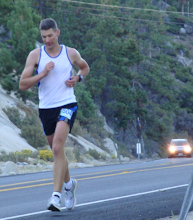
Sarah at the start of Sierra to the Sea (Photo Courtesy PCTR)
Wendell and Sarah have both run and hiked the entire TRT a number of times already, but always spread out over multiple days. Running the entire TRT in one go has been one of the things I personally want to do. In fact, I'd like to attempt to break the speed record (currently at 46 hours, held by Tim Twietmeyer). If everything goes well, I'll try that in 2008.
How do you run 165 miles in one go? I could not wait to ask Wendell and Sarah all the questions I have been wondering about and they were kind enough to take the time to answer all of them. So here it goes:
PL: Congrats on your recent run, Wendell. How many times have you and Sarah run or thru-hiked the TRT?
WD: Thanks. Sarah has completed the TRT twice. Both times in stages over 4 and ¼ days (58 hrs. 32 min. in 2003 and 56 hrs. 25 min. in 2006) I did it in stages with Whit Rambach over 4 and ¼ days (42 hours 9 min. in 2004).
PL: Was this (under 66 hrs) your fastest time?
WD: This was the only time I’ve run the TRT continuously.
PL: Where did you start and in which direction did you run? (And, if that is not the traditional route, from Tahoe City, clockwise, why?)
WD: We’ve always started at Tahoe City, but headed counter-clockwise. We like to get the Desolation Wilderness section done early on. It’s the longest (32 miles) and most difficult section without aid.
PL: Which section was the toughest and which one was the easiest?
WD: Actually, the easiest section is typically the 12-mile section from Kingsbury North to Spooner Summit. However, this year this section was the most difficult for me because it is so exposed. I passed through from 12:30 p.m. to 5:30 p.m. in the heat of the day (mid 90's) and the sun was very intense. The easiest section was the first section from TC to Barker Pass.
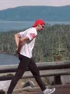
 Wendell takes off at one of the TRT trailheads (Photo Courtesy PCTR)
WD: Sarah met me at:
- Barker Pass – 17 miles
- Echo Lake – 32 miles (longest)
- Echo Summit – 2 miles
- Big Meadow - 15 miles
- Kingsbury South – 22 miles
- Kingsbury North – 4 miles
- Spooner Summit – 12 miles
- Tahoe Meadows – 23 miles
- Brockway Summit – 19 miles
- Tahoe City – 19 miles
All access points are easy to drive to. I used my cell phone a few times on the trail, but most of the time there isn’t a signal.
PL: What time did you start and end?
WD: I started at 3:28 a.m., Saturday, 9/1/07 and finished at 9:18 p.m. on Monday 9/3/07.
PL: Did you sleep at all, and if so, where?
WD: I slept a total of ~ 4 ½ hours throughout the adventure:
- One hour at 12:30 a.m. Sunday at Big Meadow
- Two 15 minute naps on the trail early Sunday morning between Big Meadow and Kingsbury South
- Two 15 minute naps on the trail Sunday afternoon between Kingsbury North and Spooner Summit 1, 15 minute nap at Spooner Summit at 5:30 p.m., Sunday
- One 15 minute nap on the trail at ~ 2 a.m. Monday morning between Spooner Summit and Tahoe Meadows
- One hour at 4 a.m. Monday at Tahoe Meadows
- One hour at 1:30 p.m. Monday afternoon at Brockway Summit
PL: Did you try to time it to be at specific sections for the night runs?
WD: Yes, I timed the start so that I’d complete the Desolation Wilderness section, including the technical Echo Lakes section, in daylight. I expected it to take 60 hours. I timed the start so I’d run 3 days and 2 nights as opposed to 3 nights and 2 days.
 Continuous Forward Motion (Photo Courtesy PCTR)
PL: How well is the trail marked? Was it hard to find the trail in the dark?
WD: The course isn’t marked that well considering that it’s the TRT. I’ve done it before with a map, so it wasn’t too difficult staying on the trail this time. I have a pretty good sense of where I am and where I need to go after I’ve run a course once. I didn’t carry a map with me this time.
The section around Dick’s Pass is difficult without a map. Many intersections are not marked at all with TRT or PCT and there are a lot of trails around that area. Also, the beginning of the last five-mile section on Cinder Cone was almost impossible to find in the dark. It’s all rocks and it’s difficult to determine a trail on the flat section about a mile from the top.
PL: Did you run into any animals?
WD: Yes, I saw 2 bears. One before Barker Pass and the second at the top of Cinder Cone before the finish.
PL: Let's talk about your gear. What did you use?
- Hydration pack/water supply? Ultimate Direction pack with a 100 oz Camelbak bladder and one 20 oz handheld UD bottle.
- Headlamp(s)? No headlamp; I use handhelds. One, 3 LED light and one, 1 LED backup light. Changed batteries once.
- Clothing? running clothes/extra layers? Running shorts, Mountain Hardwear Polyester Shirt, Patagaonia Houdini shell (night), and gloves at night.
- Trekking poles (Note: the speed record was set using poles)? No
- Shoes? Vasque Blur
PL: What did you eat during the run?
WD: Chocolate milk, goldfish crackers, Payday bars, ginger cookies, Clif Bloks, Swedish fish candy, Pizza, Starbucks Frappuccino, Hamburger, Taco Bell tacos, French Toast, English Muffin, Eggs, Ham, Hash Browns, and a Tri-tip sandwich.
PL: Did you use a GPS tracking device? Any idea of the exact distance and amount of elevation loss and gain? I have heard many different distances (164-168 miles).
WD: No GPS, no map. Last time I took the new section around Tamarack Peak and I estimated 167 mi. I used an altimeter to calculate 24,240 feet of elevation gain. This time was about 165 miles and the same elevation gain.
PL: On a run like this you must go through a lot of ups and downs. What helped you pull through in the difficult times?
WD: I stopped at 56 miles this year at Hardrock because I wasn’t having fun and I wasn’t motivated, since I’d done it twice already. I didn’t want another DNF. I was about to stop the first night at Big Meadow because I thought I was going too slowly to finish in time for Aaron (12 years old) to get back for school on Tuesday. I had made a miscalculation and Sarah corrected me and kept me going.
PL: What was the most memorable moment of your race?
WD: Sarah buying me breakfast at the casino near Incline Village at 5 a.m. Monday morning.
PL: Anything you would have done differently?
WD: I would have rested more the week before and started a little later than 3:30 a.m. 6 a.m. would have been better. Maybe do it in October when the weather is cooler.
PL: When will this be added to the PCTR calendar of events?
WD: Funny.
PL: Is there anything else you would like to share about any of your TRT runs?
WD: Doing the TRT continuously was much more difficult than I expected. If I hadn’t DNF'ed at Hardrock this year, I probably would have stopped my attempt. I’m very happy to have done it but I don’t plan on doing it this way again. Doing it is stages is much more enjoyable.


6 comments:
What a wonderful interview. Thanks Pete, Wendell, Sara and Aaron!
Congratulations to the 3 of them for this amazing adventure.
Rajeev
Great adventure! awesome interview.
Thanks for sharing Pete.
Congrats Wendell, amazing!
that was a great interview. i really enjoyed the insight. i'd love to through run trt in one shot some time next year.
thanks for sharing, pete.
cheers!
hao
Way to go Wendell! What a memorable family adventure! Fun interview Peter.
Looking for someone to run trails in the Alta area but am willing to drive to the Truckee area too. Distance: from 45 minutes to 2 hours depending on terrain. We can talk about speed. Weekends are best for me.
Krisw111@aol.com
Parabéns campeão!!!!
Post a Comment