
On Sunday, Sean and I headed up to Tahoe City to hike section 8 of the Tahoe Rim Trail (TRT). We were going to hike from Barker Pass to Tahoe City (16.7 miles) or to a secondary trailhead on Ward Creek Blvd. about 5.1 miles before Tahoe City.

Twin Peaks, Our Destination, in the Background 

We left fairly early and stopped to buy some delicious sandwiches and pastries for later at Tahoe House Bakery in Tahoe City. Since it would just be the two of us, I parked my mountain bike at the bakery, because I would zip back up to Barker Pass to pick up the truck after we were done hiking.
Tahoe House Bakery
Unfamiliar with this section, I had read the instructions on how to get there in Tim Hauserman's The Tahoe Rim Trail: A Complete Guide for Hikers, Mountain Bikers, and Equestrians (a fantastic reference guide). Well, the book did not say anything about Barker Pass Road being closed after November 1st, but that is probably because it is very rare not to have snow on the mountains yet at this time of the year, especially on this section of the TRT. A gate blocked us from driving up the road, but there was another road (Blackwood Canyon Snow Area), which I thought might be an alternate way up to the pass. Taking that road, however, required a permit, so we drove around trying to find one of the stores that sells these permits.
Barker Pass Road -- Access Denied!
The friendly folks at the outdoor sports store Alpenglow in Tahoe City told us that there was no alternate road up to Barker Pass (the permit was only good for the snow area at the bottom of Blackwood Canyon) and then they told us how to get to another trailhead on Ward Creek Boulevard and we decided to just go for an out and back hike starting at Ward Creek.

View From a Peak Just Below Twin Peaks
We found the Ward Creek Blvd. trailhead easily (Hwy 89 South from Tahoe City, right on Pineland Dr, left on Ward Valley, which becomes Ward Creek Blvd. The TRT kiosk is a few miles up the road on Ward Creek Blvd.)

Right on Pineland... Left on Ward Valley and continue on Ward Creek Blvd.

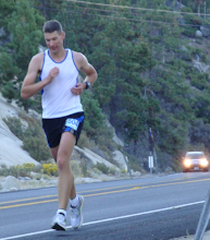
I was trying out some new Montrail Hardrock shoes that I had bought on sale at REI. Now that the racing season is over, I want to try a lot of new things. I think I still have to find the perfect TRT trail shoe. As for the Montrails, I have to say these shoes require a little bit of wearing in. I had to get used to the shoes' weight and stiffer soles compared to my road shoes, but at the end of the day my feet felt good and they are definitely a comfortable ride. I'll have to break them in a bit more, but so far so good. (And no, I am not trying to get any free stuff out of this blog post, especially now that Montrail has pretty much disbanded their running team).

Montrail Hardrock Feeling at Home
The first few miles run along Ward Creek and are pretty flat. Some signs warn people not to remove fallen trees from the creek as they provide a habitat for lots of fish varieties, such as the Tahoe Sucker (and you thought that Tahoe Suckers were those people who come up to the casinos to deposit their paychecks in the slot machines!).

Fish, like the Tahoe Sucker, Rely on Fallen Logs in the Creek
The TRT reference guide book described crossing the creek at an old washed out bridge, but thanks to the efforts of the TRT organization, we did not have to get wet; a beautiful new bridge was built across the creek just this year and it still looked very shiny.

The New Ward Creek Bridge
After crossing the creek, the trail started to climb. In the distance we could see Twin Peaks and the trail wound itself trough meadows and woods to get there. Some of the sections were very steep. After hiking for about two hours, we stopped for lunch. We had worked up quite an appetite and those sandwiches sure tasted great!

Onwards! We kept climbing until we hit a huge rock formation just below Twin Peaks. We sat there for a while enjoying the gorgeous view of Lake Tahoe and then we climbed to the top, on the backside of Twin Peaks. The views at the top are simply amazing. Almost every corner turned into a Vista Point, one more spectacular than the other.

A Pratially Frozen Waterfall on the Trail
We decided to push on towards the TRT/PCT (Pacific Crest Trail) junction, but were pleasantly surprised when we reached it almost as soon as we passed Twin Peaks. Sean took a right turn and ran on the PCT (towards Canada) for about 50 yards. One day, when Sean and Rocky are old enough, we plan to hike the entire PCT (Watch out David Horton!).

TRT/PCT Junction

One of the Most Spectacular Views on this Section of the Trail

Nuun in the Afternoon at the Top
We headed back and in no time, we had covered several miles. We continued our hike and stopped for a few quick breaks. It was very quiet on the trail. All in all we only saw about five mountain bikers and 4 hikers. We walked back to the truck, picked up the bike, and headed home (not without a stop at Village Pizzeria in Truckee first, of course).

Trail Cleanup -- Leave No Trace? How About, Leave No Socks!
It looks like the weather is going to change after next weekend, so maybe I can hike yet another section next weekend...

Elevation Profile of the Twin Peaks Ascent Hike


3 comments:
Do you know where there is info about trails that run west off of the Tahoe Rim trail. For example, it would be interesting to explore the roads and valley that drop down west of the terminus of Barker Pass Road (terminus=where the picnic tables and sign are). Love to explore 'the other side' of Alpine, Barker Pass, etc.
I haven't explored that area too much (off the TRT).
I found this description on the TRT site:
http://www.tahoerimtrail.org/index.php?option=com_content&view=article&id=118&Itemid=125
Check out Tim Hauserman's TRT book for alternative roads as well.
This is a great post thanks
Post a Comment