
On Sunday, we decided to take advantage of the beautiful fall weather, to hike from Spooner Summit (7146')to the Kingsbury North trailhead (7792') on "Section 4" of the Tahoe Rim Trail (TRT). This is one of the easiest and shortest sections of the entire 165-mile trail and with the changing weather, it could have been one of the last snow-free hiking days on the trail this year.
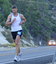
At the Trailhead --Tahoe City 102 Miles! (Rocky figured out how to make the camera's self timer work)
The section length is 12.2 Miles from trailhead to trailhead. An additional 3 miles will get you to Hwy 207 (Kingsbury Grade), from where you can hike another +/-1.5 miles to the Kingsbury South trailhead. Alternatively you can follow Kingsbury Grade in the other direction to the intersection of Hwy 207 and Hwy 50 in Stateline Nevada, close to the casinos.
 A Beautiful Day on the Trail
Getting there is easy. The Spooner Summit trailhead is located about a half mile east of the intersection of Hwy 50 and Hwy 28. The trail starts with a steep and steady climb, but it gets less steep as the trail progresses. The highest point of the trail is South Camp Peak (8800')around 5.5 miles from Spooner Summit, so you can hike with negative splits starting from either direction (although it would be easier to start at Kingsbury North, because that is about 650' higher than Spooner Summit)
 Interesting Rock Formations
Since we got a little bit of a late start, we decided that Vicky and the kids would hike approximately 3.5 miles out and back, with a lunch stop at the intersection with a forest service road around 3 miles. I would then keep going and catch up with them in Stateline, NV. Alternatively I could call to have them pick me up at the Kingsbury North trailhead, but I found out that there is no "can-you-hear-me-now" coverage (Verizon) anywhere from Kingsbury North to Stateline, so I was basically forced to add the extra 5 mile hike, because I could not reach them. That was no problem though, it was a nice walk.
 Lots of Young Fir Trees Line the Beginning of the Trail
The trail was very easy to follow and it was marked well in the few places where other trails or forest service roads crosses the TRT. I wanted to get this section of the trail mapped on my GPS for next year's TRT thru-run, but after hiking it I don't think it will be important to bring a GPS for this particular section (unlike some of the other sections!).
King of the Mountain
On this section, you get the best view from the top of South Camp Peak. From here, you can see for miles around and you can also see Genoa Peak (9150') on the other side of the mountain range.
 Genoa Peak
The views on this section are great. There are wonderful views of the lake, the mountain peaks around the lake, and lots of pine trees, young and old. I also came across what I think was an old copper mine with some warning signs on it.
 Old Copper Mine?
Surprisingly, there were not too many hikers and bikers out on the trail. However, at one point the sounds of the chirping birds, gently moving trees, and other forest creatures was rudely interrupted when I was passed by a couple of guys on motorcycles (motor vehicles are not allowed on the TRT), tearing down the trail. It is a real pity that some people just don't care about all the hard work that has gone into bulding this beautiful trail!

An Unwelcome Sight: Motorcycles -- Take a Hike!
After South Camp Peak, the trail descends to Kingsbury North. Even though I had planned to just hike the trail, I could not resist running the downhill sections. It was great fun and the stunning views just kept coming, corner after corner.
 Big Trees and Big Rocks Everywhere
On one of the final turns, Heavenly came into sight, signalling that I was close to the end of the trail. The TRT section map pointed out that this section is 12.2 miles long and my Forerunner measured it to be 12.1 from trailhead to trailhead, so that was pretty accurate.
 View from Heaven(ly)
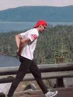
Since I did not have any cell phone coverage at the trailhead, I ran down the street (Andria, which turns into N. Benjamin) to Kingsbury Grade. The total distance at that point was about 14 miles.
 The Kingsbury North Trailhead
While the TRT continued to the left, away from the lake, I took a right turn on Hwy 207 and ran down to the corner of Hwy 207 and Hwy 50 (another 3 miles), where Vicky and the kids picked me up. We headed home and finished the day with a great-tasting pizza at
Village Pizzeria in Truckee, which I think is simply the best pizza place in the area.
 Hwy 207 (Kingsbury Grade) and N. Benjamin
TRT Section 4 -- Reference Information
Spooner Summit to Kingsbury North
Elevation Lowest: 7146' Highest 8800'
Distance 12.2 Miles (Between Trailheads)
Motion Based GPS Details [
Link]
GPX Track (you can load this into your GPS device) [
Link]
Elevation Profile for this section:

Check out my New GlobalMotion Article about this section:
Tahoe Rim Trail Section 4 Spooner Summit to Kingsbury North at GlobalMotion
Map created using GlobalMotion, the free location wiki
Next up, the Turkey Trot 10K (last race in the Gold Country Grand Prix) on Thursday!

 A Beautiful Day on the Trail
 Interesting Rock Formations
 Lots of Young Fir Trees Line the Beginning of the Trail
 Big Trees and Big Rocks Everywhere
 View from Heaven(ly)
 The Kingsbury North Trailhead
 Hwy 207 (Kingsbury Grade) and N. Benjamin


1 comment:
Peter, looks like you picked a better day than me to head into the high country. I went out Monday in the Grouse Ridge area and boy, was it stormy.
Hope the Turkey Trot went well. Looking forward to the report.
Catherine
Post a Comment