Palomar Observatory (Elevation 5586')
Palomar Mountain Run Stats
- Distance: 11. 76 Miles
- Start Elevation: 2,674'
- Finish Elevation: 5,586'
- Elevation Gain: 4,499
- Elevation Loss: 1,586
- Net Elevation Change: 2,912
- MotionBased Details: Here
- Fastest Time Run: ? (Post a Comment if You Know)
- My Time: 2:11:13 (7-1-2009)
 Intersection at Mile 7 (Follow S-6 to the Observatory)
We recently went on vacation to San Diego where we spent many days on the beach. San Diego is also a great place for running--the weather seems to always be just perfect and there are lots of great locations like Torrey Pines (great for 1-mile hill repeats) and along the coastline on Coronado Island.
 Start of the Run: (Corner of Hwy 76 and S6 (South Grade Road)
We had visited San Diego four years ago and during that vacation we took a trip to the Palomar Observatory--an astronomical research center located on Palomar Mountain, about 80 miles northeast of San Diego in the Cleveland National Forest.
 Palomar Mountain in the Distance
Palomar Observatory sits at an elevation of 5,586 feet above sea level and the last 3000' are condensed in the 11.75-mile long County Road S6 (also known as South Grade Road).
 The Run's Elevation Profile
To reach the observatory, you first climb for seven straight miles, you then run back down for two miles to the bottom of a second mountain range, and finally you climb for three more miles to the top.
 Motionbased Elevation Details
This road is the Southern California version of the Alpe d'Huez--an uncategorized climb and one of the most technical roads around, making it a very popular bike and motorbike route.
 View from the Start of the Run
There is a nice three-mile trail (the Observatory Trail) that takes you from the Observatory Campground, located just a few miles from the top of the mountain, to the observatory. We hiked that trail during our last visit and as we drove back down I told myself that I would one day return to run the entire road to the top as fast as possible. And what better day to do this than on my 39th birthday!
 Click the Map to See It in Google Maps
We arrived at the corner of Hwy 76 and County Road S-6 around 2 p.m. and it was already pretty hot. Prior to the run, I had looked at a few maps but none of them had provided very accurate information, so I was under the impression that it was going to be a 7-mile run to the top. The SHARP CURVES NEXT 7 MILES sign at the bottom of the road only helped to further confirm this (incorrect) notion.
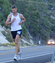
 I'm Off!
Even though it was hot, I decided to carry just one bottle. How long could this possibly take? Vicky and the kids dropped me off and they would meet me at the observatory with some tasty sandwiches.
 The Run Starts at About 2,674'
My goals for this run were to (1) run to the observatory as fast as possible and (2) not to take any walking breaks. I did not (and still don't) know what the fastest time for this run was (comment away if you know), but I would give it my best shot. The climbing started almost immediately and I settled into a slow and steady running rhythm. To make it to the top without walking, I had to keep it in first gear.
 This Sign Should Have Said Sharp Curves Next 12 Miles!
As the road snaked its way to the top, it offered some great vistas of the mountain and the surrounding area. The mileage was marked every 0.2 miles, which helped me ration my water nicely--I would take a sip at every sign. I was not the only one enjoying the challenge of this mountain; at least five motorcycles were screaming up and down the mountain while I was running and I had to jump out of the way a few times to avoid running into them.
 Handy Mile Markers Every 0.2 Miles
I climbed and climbed and found a really nice sustainable rhythm. I did not use an iPod on this run. Just running--moving higher and higher and enjoying the new views around each sharp corner, listening to the sounds of the mountain on a hot afternoon. I can highly recommend this run if you're ever in this area.
 The Views Get Better and Better the Higher You Climb
At about 6.5 miles, I finished my water. Almost there, I thought. Imagine my surprise when I rounded the final corner and saw an intersection with a store, a post office, and... a sign that read "Observatory 5 Miles." Ouch!
 Time to Summon the Power of the Mountain Goat!
It was time to regroup. I had not expected to run 12 miles up the hill and had definitely gone out too fast given the new distance, but then again, I had come this far and I was not going to walk the rest of it now!
 More Scenic Views from the Road
The first priority at this point was to get some water. I filled up my bottle in the bathroom behind the small general store and then, to get an energy boost, I ate an entire package of Powerbar gel blasts that I had (fortunately) stashed in my back pocket. These gave me just the energy boost I needed to hit the road again.
 Relentless Climbing
The next section started with a long downhill section. It felt great to run downhill for a change, but that feeling was overshadowed by the knowledge that every step down had to ultimately be made up again to get to the summit at 5586'.
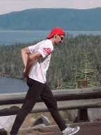
 Palomar Mountain General Store at the Intersection of S6 and S7 (5 Miles to Go)
The last three miles of the run were all uphill again. I passed the Observatory Campground and knew it would only be a few more miles. Then, tired but extremely happy, I reached the end of the county road and entered the observatory parking lot.
 County Road S-6 Ends at the Observatory Parking Lot
My son Sean joined me in a final sprint to the observatory building and at the very end we stormed up the steps. I stopped my watch the moment I touched the observatory doors: 2:11:13. What a great run!
 The Final Sprint!
I was quite happy with my time, especially given my distance miscalculation, which was a bit of a mental blow. If I were to do it again, I would run it early in the morning, of course, to avoid the heat. I also lost a few minutes getting water at the store. Having a fresh water bottle stashed there (or having a crew along the way) would have shaved off a few minutes as well. Given all that, I think that I could run sub-2 houron this course, but that would be a pretty aggressive time for me. I wish I lived closer so I could try it sooner. Unfortunately, it may be a while before I'm back there again.
 At the Observatory
I am sure there are (much) faster times out there for this epic run though.
- Has anyone else run this or do you know someone who has?
- What is the speed record (fastest known time) for running up Palomar Mountain?
- Did anyone run it up AND down?
- Any times for other versions of this course?